
DENVER – Prepare for winter driving conditions if you’re heading to the mountains starting Thursday and through the weekend, as a series of storms will bring moderate to heavy snow for the high country by early next week.
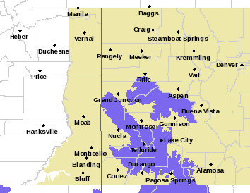
That’s the message from National Weather Service officials in Pueblo, who said a winter weather advisory will be in effect for the southern and Central Colorado mountains starting 5 p.m. Thursday through midnight Saturday.
Starting Wednesday evening into the overnight hours of Thursday, “scattered snow showers will work their way north through southwest Colorado and into the San Juan mountains, with light accumulations expected through sunset,” NWS officials in Pueblo said in their latest forecast discussion.
That weather pattern will be the forthbringer of the first wave of the storm that will pick up again Thursday into Friday morning as the system moves toward Montrose, Telluride, into Durango and then Pagosa Springs, according to Denver7 meteorologist Stacey Donaldson. Between five and 10 inches of snow are expected for the western portion of the state by then, she said.
Weather service officials did warn, however, that modeling is tricky for the area, and added that moisture expected for the region as the system moves through could make for snowfall totals that are “higher than the current forecast indicates.”
They advised those in the region or people planning on heading to the mountains from Denver to stay tuned for forecast updates over the next several days “because things could change substantially.”
National Weather Service in Boulder
Temperatures will be in the 30s from Steamboat Springs to Vail and into Aspen on Thursday, Donaldson said, adding that temperatures for the mountains overall will drop into the 20s by the weekend.
The second wave of the snowstorm will then follow.
“After a brief lull early Saturday, the northern stream will activate and snow… moderate to heavy at times… will impinge upon the northern and at times central mountain through early Monday,” weather service forecasters wrote.
Donaldson said Coloradans in the high country will see more mountain snow into Saturday and even Sunday and the 10-day forecast for Vail will keep that chance for snow through the end of the week into the weekend.
“No matter the end amounts, impacts to travel can’t be ignored Friday through at least the weekend as these storms roll through,” NWS officials said.
WHAT ABOUT THE DENVER METRO?
“It looks like more of a snow event for the higher elevations, but we could see a little bit of light snow here for the Front Range as the systems pass on by,” Donaldson said Wednesday. “We’ll see a few flurries here and definitely the cold air staying in place through the end of the week.”
Forecasters at the NWS said the plains may see isolated showers, with any precipitation that could occur for the Urban Corridor and the eastern plains expected to be light.
Wintry weather returns to the Colorado high country starting Thursday, NWS says
Weather Links
MORE: Hourly forecast | Latest forecast | Radars | Traffic | Weather Page | 24/7 Weather Stream
Stream live, current temperatures plus radars across Colorado anytime for free on the free Denver7+ app on your TV or watch from your computer or mobile phone anytime.
Read More: World News | Entertainment News | Celeb News
247